
Marche en Famenne trails
Click on a trail to view its statistics, map and profile.
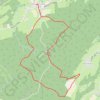
Enil Favay - Hotton - Province du Luxembourg - Belgique
Belgium > Luxembourg > Marche-en-Famenne > Hotton
Distance: 10.3 Km • Elevation gain: 217 m • Maximum elevation: 401 m
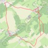
Jenneret
Belgium > Luxembourg > Marche-en-Famenne > Durbuy > Bende
Distance: 12.2 Km • Elevation gain: 235 m • Maximum elevation: 303 m

Promenade nr 2 - Paquerette (Marche en Famenne)
Belgium > Luxembourg > Marche-en-Famenne > Marche-en-Famenne
Distance: 11.3 Km • Elevation gain: 141 m • Maximum elevation: 317 m