
County Clare trails
Click on a trail to view its statistics, map and profile.

Catfish Loop Trail in Clarence Fahnestock Memorial State Park
United States > New York > Putnam County > Town of Putnam Valley > South Highland
Starting from Dennytown Road in Clarence Fahnestock Memorial State Park, the Catfish Loop Trail briefly follows the Appalachian Trail before entering quiet Hudson Highlands woodland shaped by mountain laurel, old stone walls, small streams and wetland pockets. The route then moves through rock-strewn ridge…
Distance: 7.3 Km • Elevation gain: 136 m • Maximum elevation: 306 m
Moher cliffs
Distance: 3.8 Km • Elevation gain: 418 m • Maximum elevation: 159 m
Feenlee Mountain - Moylussa - Cragnamurragh - Knockanuarha
From Twomilegate. #Hiking
Distance: 29.6 Km • Elevation gain: 974 m • Maximum elevation: 528 m
Cliffs of Moher - Stookeen Cliff
Ireland > County Clare > Doolin > Fitz's Cross
Distance: 22.6 Km • Elevation gain: 1,403 m • Maximum elevation: 158 m

Connemara - Day 3
#Bike
Distance: 62.5 Km • Elevation gain: 861 m • Maximum elevation: 291 m
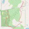
Clarence NY: Tillman Rd Wildlife Management Area southeast trail
United States > New York > Erie County > Clarence
Park, trail
Distance: 2.6 Km • Elevation gain: 12 m • Maximum elevation: 234 m
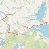
Connemara - Day 4
#Bike
Distance: 72.1 Km • Elevation gain: 662 m • Maximum elevation: 96 m
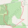
Tillman Park one of the loops South of Tillman Road
United States > New York > Erie County > Clarence
Distance: 2.0 Km • Elevation gain: 10 m • Maximum elevation: 234 m
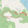
Killlaloe MTB trails
Distance: 10.2 Km • Elevation gain: 443 m • Maximum elevation: 378 m