Import a GPX file

La Voie des Erables trails

Click on a trail to view its statistics, map and profile.
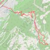
La Voie des Erables

Switzerland > Wallis > Martigny > Riddes

Cet itinéraire permet de découvrir Isérables, son histoire et son architecture en vous guidant à travers champs, forêts et rochers, entre barrières et passerelles.

Distance: 9.8 Km • Elevation gain: 993 m • Maximum elevation: 1,193 m

Gear up for your next adventure:

🎧Wireless Earbuds - Music on the move
🩻Outdoor Health Essentials - Necessary health items for hikes
🎒Waterproof Backpacks - Protect your gear from rain on Irish hikes
🗺️Topographic Maps - Detailed maps for hiking, cycling and planning routes
💺Camping Hammocks - Relax afloat camp setup

As an Amazon Associate, this site earns from qualifying purchases at no extra cost to you.