Import a GPX file

Langogne Source Lac d Issarles trails

Click on a trail to view its statistics, map and profile.
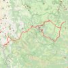
Langogne-Source-Lac d'Issarles

France > Occitania > Lozère > Langogne

This is track no: 1

Distance: 78.8 Km • Elevation gain: 1,661 m • Maximum elevation: 1,414 m

Gear up for your next adventure:

🌦️Weatherproof Outdoor Gear - Protection from unpredictable weather
🧊Winter Boot Traction - Grip for icy paths in the Mourne or Derryveagh mountains
🎒Technical Hiking Daypacks - Ergonomic backpacks with hydration bladder compatibility
🧯Camp Safety Kits - All‑in‑one safety gear
📍Trail Markers & GPS - Tools to track and mark trails

As an Amazon Associate, this site earns from qualifying purchases at no extra cost to you.