Import a GPX file

Le Pic du Midi de Bigorre par le sentier des muletiers trails

Click on a trail to view its statistics, map and profile.
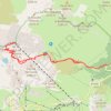
Le Pic du Midi-de-Bigorre par le sentier des muletiers

France > Occitania > Hautes Pyrenees > Campan

Distance: 18.8 Km • Elevation gain: 1,714 m • Maximum elevation: 2,855 m

Gear up for your next adventure:

🗺️Irish Road Atlases - Comprehensive physical maps for road trips and navigation
🚰Hydration Packs - Hands‑free water storage for hikers
🥾Waterproof Hiking Boots - Best waterproof boots for wet Irish weather
📸Travel Camera Tripods - Steady shots for landscape and long-exposure photos
📈Fitness Trackers - Monitor activity and hike metrics

As an Amazon Associate, this site earns from qualifying purchases at no extra cost to you.