Import a GPX file

Le tour de Saint cucufa trails

Click on a trail to view its statistics, map and profile.
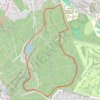
Le tour de Saint cucufa

France > Ile-de-France > Hauts-de-Seine > Rueil-Malmaison

https://en-gb.gps-viewer.com/track-lwkzs/Le-tour-de-Saint-cucufa/

Distance: 4.3 Km • Elevation gain: 73 m • Maximum elevation: 167 m

Gear up for your next adventure:

🩻Outdoor Health Essentials - Necessary health items for hikes
🧢Waterproof Caps - Keep rain off your face and glasses while hiking
📖Outdoor Guide Books - Expert guides for Irish nature
🔦UV Flashlights - Search for minerals or inspect maps at night
📍Trail Markers & GPS - Tools to track and mark trails

As an Amazon Associate, this site earns from qualifying purchases at no extra cost to you.