Import a GPX file

Zwalm Puyenbroeck 68k trails

Click on a trail to view its statistics, map and profile.
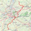
Zwalm-Puyenbroeck-68k

Belgium > East Flanders > Oudenaarde > Zwalm > Sint-Denijs-Boekel

name=Zwalm-Puyenbroeck-68k

Distance: 68.3 Km • Elevation gain: 248 m • Maximum elevation: 54 m

Gear up for your next adventure:

🕶️Polarized Sunglasses - Reduce glare outdoors
🔋Lithium Batteries - Best performance for digital devices in cold weather
🧤Touchscreen Glove Liners - Use your mapping app without freezing your hands
🚨High-Decibel Whistles - Standard safety gear for mountain signaling
🧦Hiking Socks - Comfortable socks to prevent blisters

As an Amazon Associate, this site earns from qualifying purchases at no extra cost to you.