
Canal du Midi trails
Click on a trail to view its statistics, map and profile.
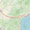
Canal du Midi
France > Occitania > Haute-Garonne > Ramonville-Saint-Agne
Distance: 264.9 Km • Elevation gain: 1,078 m • Maximum elevation: 197 m
Click on a trail to view its statistics, map and profile.
France > Occitania > Haute-Garonne > Ramonville-Saint-Agne
Distance: 264.9 Km • Elevation gain: 1,078 m • Maximum elevation: 197 m
As an Amazon Associate, this site earns from qualifying purchases at no extra cost to you.