Import a GPX file

2015 07 19 Mt Fallere trails

Click on a trail to view its statistics, map and profile.
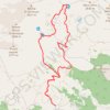
2015-07-19 Mt Fallere

Italy > Aosta Valley > Saint-Pierre > Vetan Villette

Mt Fallere vanuit Vetan 6,5h 1400m up and down 19km

Distance: 18.1 Km • Elevation gain: 1,457 m • Maximum elevation: 3,029 m
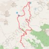
2015-07-19 Mt Fallere

Italy > Aosta Valley > Saint-Pierre > Vetan Villette

Distance: 18.1 Km • Elevation gain: 1,454 m • Maximum elevation: 3,028 m

Gear up for your next adventure:

🌲Survival Gear - Equipment for outdoor survival situations
🔭Portable Monoculars - One-handed optics for quick route checking
💧Portable Water Filters - Safe drinking water from streams and lakes
🧯Camp Safety Kits - All‑in‑one safety gear
📍Trail Markers & GPS - Tools to track and mark trails

As an Amazon Associate, this site earns from qualifying purchases at no extra cost to you.