Import a GPX file

44K trails

Click on a trail to view its statistics, map and profile.

44K

Belgium > East Flanders > Oudenaarde > Zwalm > Sint-Denijs-Boekel

name=44K

Distance: 44.2 Km • Elevation gain: 222 m • Maximum elevation: 72 m
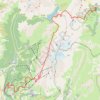
Trail de l’Étendard - 44km

France > Auvergne-Rhône-Alpes > Isère > Le Bourg-d'Oisans > Le Bassey

Distance: 45.0 Km • Elevation gain: 3,160 m • Maximum elevation: 2,726 m

Gear up for your next adventure:

🪶Down Jackets - Warm jackets for cold outdoor trips
🚰Portable Water Filters - Safely drink from Irish streams and mountain lakes
🧤Thermal Outdoor Gloves - Windproof and waterproof gloves for winter hiking
🔌Fast Car Chargers - Recharge GPS and phones between trailheads
🧴Hiking Sunscreen - Sun protection for long exposure

As an Amazon Associate, this site earns from qualifying purchases at no extra cost to you.