Import a GPX file

Le tour de Saint cucufa trails

Click on a trail to view its statistics, map and profile.
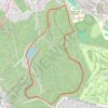
Le tour de Saint cucufa

France > Ile-de-France > Hauts-de-Seine > Rueil-Malmaison

https://en-gb.gps-viewer.com/track-lwkzs/Le-tour-de-Saint-cucufa/

Distance: 4.3 Km • Elevation gain: 73 m • Maximum elevation: 167 m

Gear up for your next adventure:

🧺Waterproof Picnic Blankets - Dry seating for breaks on damp grass
🧭Hiking Compasses - Reliable compasses for navigation off‑trail
🥾Men's Waterproof Boots - Sturdy footwear for wet and boggy Irish terrain
🧤Touchscreen Glove Liners - Use your mapping app without freezing your hands
🍖High-Protein Trail Snacks - Lightweight fuel for long distance treks

As an Amazon Associate, this site earns from qualifying purchases at no extra cost to you.