Import a GPX file

Pico Tentes desde el col de Tentes trails

Click on a trail to view its statistics, map and profile.
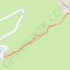
Pico Tentes desde el col de Tentes

France > Occitania > Hautes Pyrenees > Gavarnie-Gèdre > Gavarnie

Distance: 1.3 Km • Elevation gain: 100 m • Maximum elevation: 2,309 m

Gear up for your next adventure:

🥣Outdoor Food & Meals - Dehydrated meals for backpacking
🔋Lithium Batteries - Best performance for digital devices in cold weather
🧿Outdoor Gadgets - Innovative tools for outdoor enthusiasts
🔦Everyday Carry Torches - Reliable backup light for your hiking pack
🥘Camping Cookware Sets - Cookware sets for backpacking meals

As an Amazon Associate, this site earns from qualifying purchases at no extra cost to you.