Import a GPX file

McDowell County trails

Click on a trail to view its statistics, map and profile.
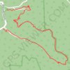
Loop Trail - Panther State Forest

United States > West Virginia > McDowell County

Hiking, trail

Distance: 6.1 Km • Elevation gain: 331 m • Maximum elevation: 588 m
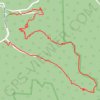
Loop Trail - Panther Wildlife Management Area

United States > West Virginia > McDowell County

Hiking, trail

Distance: 6.1 Km • Elevation gain: 334 m • Maximum elevation: 588 m

Gear up for your next adventure:

📱Rugged Smartphones - Waterproof phones with long battery for offline mapping
🎽Thermal Base Layers - Essential moisture management for cold weather
📡Satellite Messengers - Emergency messaging when off‑grid
🥾Men's Waterproof Boots - Sturdy footwear for wet and boggy Irish terrain
📦Gear Organizers - Organize outdoor equipment

As an Amazon Associate, this site earns from qualifying purchases at no extra cost to you.