Import a GPX file

Maglic trails

Click on a trail to view its statistics, map and profile.
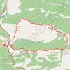
Stolovi: od Magliča grebenom Lipar, vrh Usovica, povratak gr...

Serbia > Central Serbia > Raska Administrative District > Maglic

Distance: 16.3 Km • Elevation gain: 1,362 m • Maximum elevation: 1,372 m

Gear up for your next adventure:

🎧Wireless Earbuds - Music on the move
🌄Sun Protection Gear - Gear to shield from strong sun
🚶‍♂️Trekking Poles - Supportive poles for stability on varied terrain
🧦Hiking Socks - Comfortable socks to prevent blisters
📡Satellite Messengers - Emergency communication for remote areas without signal

As an Amazon Associate, this site earns from qualifying purchases at no extra cost to you.