Import a GPX file

Maredret trails

Click on a trail to view its statistics, map and profile.
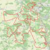
EPIC200 2021_100KM_edit7_6

Belgium > Namur > Dinant > Maredret > Maredsous

<p>De: RAVeL L150, Maredsous, Anhée, Namur, Wallonie<br/> À: RAVeL L150, Maredsous, Anhée, Namur, Wallonie</p> <p>Routage: Le plus court - OSM, Manuellement</p>

Distance: 101.5 Km • Elevation gain: 2,164 m • Maximum elevation: 268 m

Other places

Gear up for your next adventure:

💳Travel Cards for Ireland - Convenient payment abroad
💺Camping Hammocks - Relax afloat camp setup
📻Emergency Crank Radios - Stay informed in remote areas without power
🛠️Tent Repair Kits - Fix tents on the trail
🔦High-Lumen Headlamps - Hands-free lighting for early starts or late finishes

As an Amazon Associate, this site earns from qualifying purchases at no extra cost to you.