Import a GPX file

Les Houches trails

Click on a trail to view its statistics, map and profile.
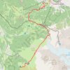
Day 01: Les Houches to Auberge du Truc

France > Auvergne-Rhône-Alpes > Upper Savoy > Les Houches > Le Fouilly

Distance: 14.1 Km • Elevation gain: 1,480 m • Maximum elevation: 2,117 m

Gear up for your next adventure:

🔦High-Lumen Headlamps - Hands-free lighting for early starts or late finishes
📈Fitness Trackers - Monitor activity and hike metrics
📊Altimeters & Barometers - Track elevation and weather changes
📚Irish Walking Guides - The best mapped trails in Wicklow, Kerry, and Connemara
🥾Mountaineering Boots - Heavy‑duty boots for rugged peaks

As an Amazon Associate, this site earns from qualifying purchases at no extra cost to you.