Import a GPX file

Les Houches trails

Click on a trail to view its statistics, map and profile.
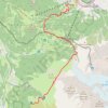
Day 01: Les Houches to Auberge du Truc

France > Auvergne-Rhône-Alpes > Upper Savoy > Les Houches > Le Fouilly

Distance: 14.1 Km • Elevation gain: 1,480 m • Maximum elevation: 2,117 m

Other places

Gear up for your next adventure:

🎽Thermal Base Layers - Essential moisture management for cold weather
🖼️Vintage Irish Map Prints - Decorative wall art for map lovers and geographers
📍Trail Markers & GPS - Tools to track and mark trails
🔌Fast Car Chargers - Recharge GPS and phones between trailheads
💺Camping Hammocks - Relax afloat camp setup

As an Amazon Associate, this site earns from qualifying purchases at no extra cost to you.