Import a GPX file

Thira Regional Unit trails

Click on a trail to view its statistics, map and profile.
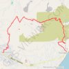
Profitis Ilias de Santorin

Greece > Aegean > Thira Regional Unit > Thira Municipal Unit > Emporio

Distance: 7.7 Km • Elevation gain: 533 m • Maximum elevation: 550 m

Other places

Gear up for your next adventure:

🗺️Topographic Maps - Detailed maps for hiking, cycling and planning routes
💳Travel Cards for Ireland - Convenient payment abroad
🔧Bicycle Repair Kits - On‑the‑go bike maintenance tools
🪀Camping Games - Fun for group camping trips
🔒Outdoor Gear Locks - Secure your equipment

As an Amazon Associate, this site earns from qualifying purchases at no extra cost to you.