Import a GPX file

Arilje Municipality trails

Click on a trail to view its statistics, map and profile.
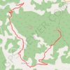
Trenutna trasa: 10 SIJ 2021 10:40

Serbia > Central Serbia > Zlatibor Administrative District > Arilje Municipality > Dobrace

Distance: 17.2 Km • Elevation gain: 683 m • Maximum elevation: 1,082 m

Trasa 016

Serbia > Central Serbia > Zlatibor Administrative District > Arilje Municipality > Brekovo

Distance: 20.4 Km • Elevation gain: 670 m • Maximum elevation: 1,193 m

Other places

 •

Gear up for your next adventure:

🍁Eco‑Friendly Outdoor Products - Sustainable outdoor gear
🩴Trail Running Shoes - Fast, grippy shoes for trail runs
🔦UV Flashlights - Search for minerals or inspect maps at night
🔗Locking Carabiners - Secure gear to your pack or for light climbing
🥾Women's Waterproof Boots - Gore-Tex protection for trail and mountain walking

As an Amazon Associate, this site earns from qualifying purchases at no extra cost to you.