
Jefferson County trails
Click on a trail to view its statistics, map and profile.
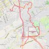
Walking Five Points, Highland Park, Key Circle, Botanical Gardens, Mountain Brook Village
United States > Alabama > Jefferson County > Birmingham > Five Points South
Distance: 9.1 Km • Elevation gain: 157 m • Maximum elevation: 296 m
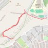
Moss Rock Preserve
United States > Alabama > Jefferson County > Hoover
Distance: 2.6 Km • Elevation gain: 30 m • Maximum elevation: 205 m
Turkey Creek
United States > Alabama > Jefferson County > Pinson
Distance: 0.6 Km • Elevation gain: 19 m • Maximum elevation: 182 m