
Belfast trails
Click on a trail to view its statistics, map and profile.
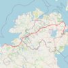
CTS-N.Irelandv1.1-Belfast-Titanic>Enniscrone-via antrim coast-209miles
United Kingdom > Northern Ireland > County Down > Belfast
Distance: 335.8 Km • Elevation gain: 3,985 m • Maximum elevation: 271 m
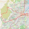
Cycle up Divis and Black Mountain
United Kingdom > Northern Ireland > County Down > Belfast
Divis, Black Mountain, Cycle, Bicycle
Distance: 26.7 Km • Elevation gain: 426 m • Maximum elevation: 383 m
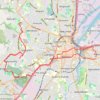
Forth Meadows Greenway, Belfast
United Kingdom > Northern Ireland > County Down > Belfast
Cycling
Distance: 25.4 Km • Elevation gain: 233 m • Maximum elevation: 78 m
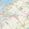
Scrabo Loop
United Kingdom > Northern Ireland > County Down > Belfast
Cycling belfast, newtownards, comber, dundonald, holywood, bicycle
Distance: 41.5 Km • Elevation gain: 401 m • Maximum elevation: 156 m