
Tulsa County trails
Click on a trail to view its statistics, map and profile.
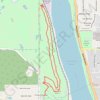
Turkey Mountain Loop via Yellow Trail in Turkey Mountain Urban Wilderness Area
United States > Oklahoma > Tulsa County > Tulsa
The Turkey Mountain Loop via the Yellow Trail offers a moderately challenging hike through Tulsa’s natural landscapes, complete with forested paths, rocky stretches, and scenic overlooks of the Arkansas River. This loop winds through diverse terrain, providing a rewarding mix of tranquility and rugged…
Distance: 6.4 Km • Elevation gain: 124 m • Maximum elevation: 275 m
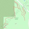
Turkey Mountain Checks and Balances MTB Trail
United States > Oklahoma > Tulsa County > Tulsa
Distance: 2.2 Km • Elevation gain: 34 m • Maximum elevation: 262 m
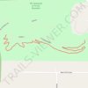
Turkey Mountain Rubble MTB Trail
United States > Oklahoma > Tulsa County > Tulsa
Distance: 1.4 Km • Elevation gain: 12 m • Maximum elevation: 257 m
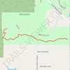
Turkey Mountain THE DAC MTB Trail
United States > Oklahoma > Tulsa County > Tulsa
Distance: 1.1 Km • Elevation gain: 15 m • Maximum elevation: 248 m
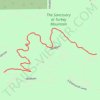
Turkey Mountain Ten Four MTB Trail
United States > Oklahoma > Tulsa County > Tulsa
Distance: 0.8 Km • Elevation gain: 2 m • Maximum elevation: 261 m
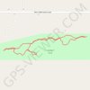
Lambert Trail
United States > Oklahoma > Tulsa County > Glenpool
Distance: 0.8 Km • Elevation gain: 5 m • Maximum elevation: 215 m