
All Stretton trails
Click on a trail to view its statistics, map and profile.
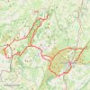
Longmynd Hike 50 miles
United Kingdom > England > Shropshire > Church Stretton > All Stretton
Distance: 77.8 Km • Elevation gain: 2,661 m • Maximum elevation: 527 m
Click on a trail to view its statistics, map and profile.
United Kingdom > England > Shropshire > Church Stretton > All Stretton
Distance: 77.8 Km • Elevation gain: 2,661 m • Maximum elevation: 527 m
As an Amazon Associate, this site earns from qualifying purchases at no extra cost to you.