Import a GPX file

Hayfield trails

Click on a trail to view its statistics, map and profile.
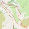
Mount Famine and South Head loop hike from Hayfield

United Kingdom > England > Derbyshire > High Peak > Hayfield

Distance: 9.1 Km • Elevation gain: 416 m • Maximum elevation: 489 m

Gear up for your next adventure:

🗺️Topographic Maps - Detailed maps for hiking, cycling and planning routes
💨Windbreakers - Protection from strong winds
🧥Gore-Tex Rain Jackets - Breathable and fully waterproof shells for Irish weather
🌲Survival Gear - Equipment for outdoor survival situations
🧢Waterproof Caps - Keep rain off your face and glasses while hiking

As an Amazon Associate, this site earns from qualifying purchases at no extra cost to you.