Import a GPX file

Jackson County trails

Click on a trail to view its statistics, map and profile.
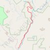
Chattooga River Trail beginning from the parking area off Whiteside Cove Road

United States > North Carolina > Jackson County

Distance: 10.9 Km • Elevation gain: 349 m • Maximum elevation: 888 m

Gear up for your next adventure:

📚Irish Walking Guides - The best mapped trails in Wicklow, Kerry, and Connemara
🎧Wireless Earbuds - Music on the move
🌦️Weatherproof Outdoor Gear - Protection from unpredictable weather
🎽Thermal Base Layers - Essential moisture management for cold weather
🔦Everyday Carry Torches - Reliable backup light for your hiking pack

As an Amazon Associate, this site earns from qualifying purchases at no extra cost to you.