Import a GPX file

Aillac trails

Click on a trail to view its statistics, map and profile.
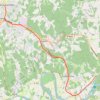
Voie Verte Périgord Quercy - De Aillac à Sarlat-la-Canéda

France > Nouvelle-Aquitaine > Dordogne > Carsac-Aillac > Aillac

Distance: 12.3 Km • Elevation gain: 186 m • Maximum elevation: 157 m

Gear up for your next adventure:

🧯Compact Fire Extinguishers - Safety for campervans and expedition vehicles
🛡️Protective Bike Gear - Helmets & pads for safe rides
🥾Mountaineering Boots - Heavy‑duty boots for rugged peaks
🧿Weather Radios - Track weather in remote places
🪀Camping Games - Fun for group camping trips

As an Amazon Associate, this site earns from qualifying purchases at no extra cost to you.