Import a GPX file

Main Ridge trails

Click on a trail to view its statistics, map and profile.
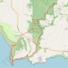
Greens Bush, Mornington Peninsula National Park and Cape schanck loop

Australia > Victoria > Melbourne > Main Ridge

Distance: 30.9 Km • Elevation gain: 632 m • Maximum elevation: 178 m

Gear up for your next adventure:

🦯Lightweight Trekking Poles - Reduce knee strain on steep Wicklow or Kerry slopes
🚨Emergency Whistles - Safety whistles for hikers
🗺️Topographic Maps - Detailed maps for hiking, cycling and planning routes
💨Windbreakers - Protection from strong winds
🦺Outdoor Safety Vests - Increase visibility and safety

As an Amazon Associate, this site earns from qualifying purchases at no extra cost to you.