Import a GPX file

Rothwell trails

Click on a trail to view its statistics, map and profile.
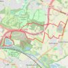
Run from Skelton Lake to Hollinthorpe and back via the north of Swillington

United Kingdom > England > Rothwell

Uncharted territory

Distance: 15.5 Km • Elevation gain: 151 m • Maximum elevation: 90 m

Gear up for your next adventure:

🗾Ireland Map Books - Top map books for exploring Ireland
🧶Camping String Lights - Ambience and utility lighting
🔌Travel Adapters - Essential for visitors to charge gear in Ireland
🧤Thermal Outdoor Gloves - Windproof and waterproof gloves for winter hiking
🎧Wireless Earbuds - Music on the move

As an Amazon Associate, this site earns from qualifying purchases at no extra cost to you.