
Netherthong trails
Click on a trail to view its statistics, map and profile.
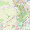
Netherthong, River Holme and Hagg Wood loop
United Kingdom > England > Kirklees > Netherthong > Deanhouse
Distance: 5.2 Km • Elevation gain: 104 m • Maximum elevation: 204 m
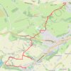
Netherthong to Holmebridge via Upperthong (HVCW)
United Kingdom > England > Kirklees > Netherthong > Deanhouse
Netherthong - Deanhouse - Upperthong - Hogley Green - Booth House - Carr Green - Hinchliffe Mill - Holmbridge - Flush House - Austonley - Digley Reservoir - River Holme
Distance: 7.0 Km • Elevation gain: 192 m • Maximum elevation: 287 m
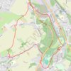
Netherthong, River Holme Riverside Loop Walk
United Kingdom > England > Kirklees > Netherthong > Deanhouse
Distance: 6.2 Km • Elevation gain: 124 m • Maximum elevation: 215 m