Import a GPX file

Needham trails

Click on a trail to view its statistics, map and profile.
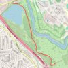
Cutler Park Kendrick Pond, Healthy Heart Trail and Blue Heron Trail

United States > Massachusetts > Norfolk County > Needham

Distance: 4.7 Km • Elevation gain: 28 m • Maximum elevation: 34 m
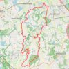
Medford Trails

United States > Massachusetts > Norfolk County > Needham

Medford/Dover trails

Distance: 43.2 Km • Elevation gain: 439 m • Maximum elevation: 122 m

Gear up for your next adventure:

🚲Cycling GPS Computers - Topographic mapping for Irish road and mountain biking
🛸Lightweight Camera Drones - Capture stunning aerial topographic views of the landscape
🔋Solar Power Banks - Keep your GPS and phone charged in the Irish wilderness
📟Handheld Altimeters - Track elevation changes and weather patterns accurately
🛶Inflatable Touring Kayaks - Explore Irish loughs and coastal topography

As an Amazon Associate, this site earns from qualifying purchases at no extra cost to you.