Import a GPX file

Guelph/Eramosa trails

Click on a trail to view its statistics, map and profile.
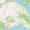
Guelph Lake Conservation Area Loop Trails

Canada > Ontario > Wellington County > Guelph/Eramosa

Distance: 6.3 Km • Elevation gain: 64 m • Maximum elevation: 373 m
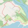
Guelph Lake Conservation Area Loop

Canada > Ontario > Wellington County > Guelph/Eramosa

Distance: 6.3 Km • Elevation gain: 65 m • Maximum elevation: 372 m

Gear up for your next adventure:

🧯Campfire Safety Gear - Gear to safely manage fires
📱Rugged Smartphones - Waterproof phones with long battery for offline mapping
🧢Waterproof Caps - Keep rain off your face and glasses while hiking
💨Windbreakers - Protection from strong winds
🥾Waterproof Hiking Boots - Best waterproof boots for wet Irish weather

As an Amazon Associate, this site earns from qualifying purchases at no extra cost to you.