Import a GPX file

Rural Municipality of Yellowhead trails

Click on a trail to view its statistics, map and profile.

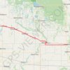
Shoal Lake - Neepawa

Canada > Rural Municipality of Yellowhead > Shoal Lake

#Bike #Shoal #Neepawa

Distance: 96.6 Km • Elevation gain: 203 m • Maximum elevation: 609 m

Other places

Gear up for your next adventure:

🔋Lithium Batteries - Best performance for digital devices in cold weather
🛰️Handheld GPS Units - Professional satellite navigation for Irish highlands
🪑Compact Camp Chairs - Comfortable seating after a long day of mapping
🖼️Vintage Irish Map Prints - Decorative wall art for map lovers and geographers
📍Handheld GPS Devices - Accurate GPS units for mapping and navigation

As an Amazon Associate, this site earns from qualifying purchases at no extra cost to you.