Import a GPX file

Church End trails

Click on a trail to view its statistics, map and profile.
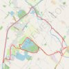
Frampton on Severn loop walk

United Kingdom > England > Gloucestershire > Stroud > Frampton on Severn > Church End

Distance: 14.0 Km • Elevation gain: 49 m • Maximum elevation: 21 m
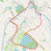
Frampton On Severn Loop Walk

United Kingdom > England > Gloucestershire > Stroud > Frampton on Severn > Church End

Distance: 7.2 Km • Elevation gain: 27 m • Maximum elevation: 21 m

Gear up for your next adventure:

🧺Quick-Dry Hiking Towels - Space-saving towels for wild swimming or camping
🧥Gore-Tex Rain Jackets - Breathable and fully waterproof shells for Irish weather
🔦UV Flashlights - Search for minerals or inspect maps at night
🔭Portable Monoculars - One-handed optics for quick route checking
💺Camping Hammocks - Relax afloat camp setup

As an Amazon Associate, this site earns from qualifying purchases at no extra cost to you.