Import a GPX file

The Blue Mountains trails

Click on a trail to view its statistics, map and profile.
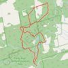
Pretty River Trail - Bruce Trail

Canada > Ontario > Grey County > The Blue Mountains

Pretty River Valley Provincial Park. #Hiking #Snowshoeing #Loop #PrettyRiverValley

Distance: 9.1 Km • Elevation gain: 289 m • Maximum elevation: 522 m
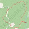
Kolapore trail loop

Canada > Ontario > Grey County > The Blue Mountains

Distance: 3.8 Km • Elevation gain: 87 m • Maximum elevation: 470 m

Gear up for your next adventure:

🚲Cycling GPS Computers - Topographic mapping for Irish road and mountain biking
🧣Multi-functional Neckwear - Protect against wind and sun with versatile Buffs
🕶️Polarized Sunglasses - Reduce glare from lakes and sea cliffs
🌦️Weatherproof Outdoor Gear - Protection from unpredictable weather
🧴Anti-Chafe Sticks - Prevent friction during long distance walking

As an Amazon Associate, this site earns from qualifying purchases at no extra cost to you.