Import a GPX file

Maring trails

Click on a trail to view its statistics, map and profile.
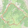
Badia Gravel/Offroad-Radfahren

Italy > Trentino – Alto Adige/Südtirol > South Tyrol > La Ila - Stern - La Villa > Maring

Distance: 29.0 Km • Elevation gain: 1,023 m • Maximum elevation: 2,161 m

Gear up for your next adventure:

🔌Fast Car Chargers - Recharge GPS and phones between trailheads
🗺️Irish Road Atlases - Comprehensive physical maps for road trips and navigation
🪶Down Jackets - Warm jackets for cold outdoor trips
👖Zip-off Hiking Pants - Adapt to changing Irish temperatures quickly
🕶️Polarized Sunglasses - Reduce glare outdoors

As an Amazon Associate, this site earns from qualifying purchases at no extra cost to you.