
Hassocks trails
Click on a trail to view its statistics, map and profile.
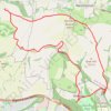
Walk - Jack and Jill Windmills, Ditchling Beacon and Stanmer Park loop
United Kingdom > England > West Sussex > Mid Sussex > Hassocks
Distance: 18.2 Km • Elevation gain: 443 m • Maximum elevation: 244 m
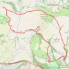
Loop walk via Jack & Jill Windmills, Ditchling Beacon and Stanmer Park
United Kingdom > England > West Sussex > Mid Sussex > Hassocks
Distance: 17.1 Km • Elevation gain: 417 m • Maximum elevation: 244 m
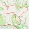
Walk - Jack and Jill Windmills, Street Farm, Stanmer Park
United Kingdom > England > West Sussex > Mid Sussex > Hassocks
Distance: 16.2 Km • Elevation gain: 375 m • Maximum elevation: 244 m