
Vojvodina trails
Click on a trail to view its statistics, map and profile.
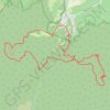
Vrsacke planine: Malo Središte - Man.Srediste - Guduricki vr...
Serbia > Vojvodina > South Banat Administrative District > Malo Srediste
Distance: 14.9 Km • Elevation gain: 825 m • Maximum elevation: 621 m
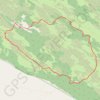
Deliblatska peščara: Bracina staza
Serbia > Vojvodina > South Banat Administrative District > Kovin Municipality > Deliblato
Distance: 12.3 Km • Elevation gain: 97 m • Maximum elevation: 148 m
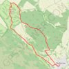
Grebenac - Zagajička brda
Serbia > Vojvodina > South Banat Administrative District > Bela Crkva Municipality > Grebenac
Distance: 14.7 Km • Elevation gain: 259 m • Maximum elevation: 243 m
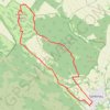
Zagajička Brda - Deliblatska peščara
Serbia > Vojvodina > South Banat Administrative District > Bela Crkva Municipality > Grebenac
Distance: 15.0 Km • Elevation gain: 250 m • Maximum elevation: 243 m