
Cley next the Sea trails
Click on a trail to view its statistics, map and profile.
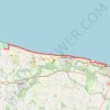
Norfolk Coast Path - Cley to Cromer
United Kingdom > England > Norfolk > North Norfolk > Cley next the Sea
norfolk-coast-path, cley-next-the-sea, weybourne, sheringham, west-runton, east-runton, cromer
Distance: 20.1 Km • Elevation gain: 282 m • Maximum elevation: 43 m
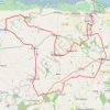
Cley next the Sea to Binham Bike Loop
United Kingdom > England > Norfolk > North Norfolk > Cley next the Sea > Newgate
#Bike #Loop #Road #Countryside #Nature
Distance: 46.5 Km • Elevation gain: 343 m • Maximum elevation: 95 m