Import a GPX file

Al Batuf Regional Council trails

Click on a trail to view its statistics, map and profile.

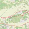
Har Turan

Israel > North District > Al Batuf Regional Council

Loop running from Rumana. #Running #Loop #Mountain #Nature #Forest #Countryside

Distance: 26.9 Km • Elevation gain: 652 m • Maximum elevation: 542 m

Gear up for your next adventure:

📱Rugged Smartphones - Waterproof phones with long battery for offline mapping
🧴Long-Lasting Sunscreen - Protect against UV rays during long days on the ridges
🚲Cycling GPS Computers - Topographic mapping for Irish road and mountain biking
📊Altimeters & Barometers - Track elevation and weather changes
🎒Backpack Rain Covers - Extra protection for non-waterproof rucksacks

As an Amazon Associate, this site earns from qualifying purchases at no extra cost to you.