Import a GPX file

Knodishall trails

Click on a trail to view its statistics, map and profile.
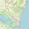
Suffolk Coast Path: Thorpeness to Aldeburgh

United Kingdom > England > Suffolk > East Suffolk > Knodishall

Distance: 21.8 Km • Elevation gain: 116 m • Maximum elevation: 24 m

Gear up for your next adventure:

🎒Fully Waterproof Rucksacks - Submersible protection for river crossings
🎒Technical Hiking Daypacks - Ergonomic backpacks with hydration bladder compatibility
🔧Bicycle Repair Kits - On‑the‑go bike maintenance tools
🪶Ultralight Tents - Lightweight shelters for hikers
🍁Eco‑Friendly Outdoor Products - Sustainable outdoor gear

As an Amazon Associate, this site earns from qualifying purchases at no extra cost to you.