Import a GPX file

Saint-Étienne-de-Baïgorry trails

Click on a trail to view its statistics, map and profile.
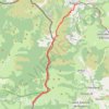
J1 V.Classique

France > Nouvelle-Aquitaine > Pyrénées-Atlantiques > Saint-Étienne-de-Baïgorry > Izpegi

Distance: 13.0 Km • Elevation gain: 688 m • Maximum elevation: 1,013 m

Other places

Gear up for your next adventure:

🦯Lightweight Trekking Poles - Reduce knee strain on steep Wicklow or Kerry slopes
🧢Hiking Hats & Caps - Protective headwear for sun and rain
🗺️Topographic Maps - Detailed maps for hiking, cycling and planning routes
⌚Solar Multisport Watches - Advanced mapping and GPS tracking for endurance hikers
🥾Women's Waterproof Boots - Gore-Tex protection for trail and mountain walking

As an Amazon Associate, this site earns from qualifying purchases at no extra cost to you.