Import a GPX file

Sheung Tsuen trails

Click on a trail to view its statistics, map and profile.
甲龍右 清潭

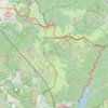
China > Hong Kong > Yuen Long District > Sheung Tsuen

Distance: 8.5 Km • Elevation gain: 431 m • Maximum elevation: 477 m

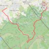
Tai Mo Shan Country Park and Shing Mun Country Park

China > Hong Kong > Yuen Long District > Sheung Tsuen > Sheung Tsuen San Tsuen

Hike through Tai Mo Shan Country Park and Shing Mun Country Park via Botanic Garden, Kwun Yam Shan, Yuk Nui Fall, Sze Fong Shan Au, Lead Mine Pass and Shing Mun Reservoir. #Hiking #Mountain #Park #Nature #Forest #Lake

Distance: 14.7 Km • Elevation gain: 1,078 m • Maximum elevation: 770 m

Other places

Gear up for your next adventure:

📱Rugged Smartphones - Waterproof phones with long battery for offline mapping
🥄Titanium Sporks - Indestructible and ultralight eating utensil
🛸Lightweight Camera Drones - Capture stunning aerial topographic views of the landscape
🥾Hiking Boots - Top hiking boots for Irish trails and rugged terrain
🥾Men's Waterproof Boots - Sturdy footwear for wet and boggy Irish terrain

As an Amazon Associate, this site earns from qualifying purchases at no extra cost to you.