Import a GPX file

Area H (North Oyster / Diamond) trails

Click on a trail to view its statistics, map and profile.
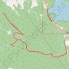
Christie Falls - Camas Ridge

Canada > British Columbia > Cowichan Valley Regional District > Area H (North Oyster / Diamond) > Diamond

#Hiking

Distance: 12.5 Km • Elevation gain: 270 m • Maximum elevation: 164 m

Other places

Gear up for your next adventure:

Smart Watches for Hiking - Track performance on trails
🪓Camping Axes & Hatchets - Wood cutting tools for campsite prep
📦Gear Organizers - Organize outdoor equipment
🚴Mountain Bikes - Bikes for off‑road trails and terrain
🧴Long-Lasting Sunscreen - Protect against UV rays during long days on the ridges

As an Amazon Associate, this site earns from qualifying purchases at no extra cost to you.