Import a GPX file

Percé trails

Click on a trail to view its statistics, map and profile.
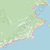
Saint-Georges-de-Malbaie - Saint-François-de-Pabos

Canada > Quebec > Le Rocher-Percé > Percé > Saint-Georges-de-Malbaie > Pointe-Saint-Pierre

Gulf of Saint Lawrence. #Bike #SaintLawrence #Atlantic

Distance: 68.7 Km • Elevation gain: 700 m • Maximum elevation: 142 m

Other places

Gear up for your next adventure:

🔋Portable Power Banks - Keep devices charged on long trips
🔋Rechargeable Batteries - Eco-friendly power for headlamps and GPS units
🛸Lightweight Camera Drones - Capture stunning aerial topographic views of the landscape
🔭Laser Distance Meters - Professional precision measuring for site surveys
🦺Outdoor Safety Vests - Increase visibility and safety

As an Amazon Associate, this site earns from qualifying purchases at no extra cost to you.