Import a GPX file

Camas trails

Click on a trail to view its statistics, map and profile.
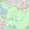
Lacamas Regional Park loop walk via Round Lake and Woodburn Park

United States > Washington > Clark County > Camas

Distance: 6.7 Km • Elevation gain: 138 m • Maximum elevation: 126 m

Gear up for your next adventure:

🍁Eco‑Friendly Outdoor Products - Sustainable outdoor gear
🧯Campfire Safety Gear - Gear to safely manage fires
🖊️All-Weather Pens - Pressurized ink cartridges that write upside down and in wet
📦Outdoor Storage Bags - Keep gear organized and dry
📊Altimeters & Barometers - Track elevation and weather changes

As an Amazon Associate, this site earns from qualifying purchases at no extra cost to you.