
Moselle trails
Click on a trail to view its statistics, map and profile.
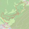
Balade entre Haspelschiedt et Roppeviller
France > Grand Est > Moselle > Haspelschiedt
Distance: 9.3 Km • Elevation gain: 272 m • Maximum elevation: 396 m
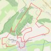
Circuit de l'ancienne route de Morville
France > Grand Est > Moselle > Vic-sur-Seille
Circuit du Bois des Loups par les Montagnes Noires et l'ancienne route de Morville avec retour par les Faluchamps.
Distance: 13.2 Km • Elevation gain: 286 m • Maximum elevation: 315 m