Import a GPX file

Tunstead Milton trails

Click on a trail to view its statistics, map and profile.
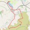
Combs Loop from Reservoir

United Kingdom > England > Derbyshire > High Peak > Chapel-en-le-Frith > Combs > Tunstead Milton

Distance: 13.2 Km • Elevation gain: 402 m • Maximum elevation: 482 m
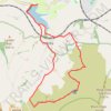
High Peak Hiking

United Kingdom > England > Derbyshire > High Peak > Chapel-en-le-Frith > Combs > Tunstead Milton

Distance: 13.5 Km • Elevation gain: 404 m • Maximum elevation: 482 m

Gear up for your next adventure:

👣Orthopedic Boot Insoles - Extra comfort for long distance walking
🌿Irish Flora Guides - Identify plants while exploring the countryside
🥾Women's Waterproof Boots - Gore-Tex protection for trail and mountain walking
💳Travel Cards for Ireland - Convenient payment abroad
🏃‍♀️Running Hydration Belts - Hydration on the go for runners

As an Amazon Associate, this site earns from qualifying purchases at no extra cost to you.