Import a GPX file

La Matanie trails

Click on a trail to view its statistics, map and profile.
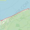
Matane - Sainte-Anne-des-Monts

Canada > Quebec > La Matanie > Matane

Saint Lawrence River. #Bike #Matane #SainteAnneDesMonts #SaintLawrence

Distance: 88.8 Km • Elevation gain: 788 m • Maximum elevation: 90 m

Other places

Gear up for your next adventure:

🛶Waterproof Dry Bags - Keep electronics and clothes dry during wet treks
🔋Solar Power Banks - Keep your GPS and phone charged in the Irish wilderness
🔗Locking Carabiners - Secure gear to your pack or for light climbing
🛍️Outdoor Accessory Kits - Bundles for new hikers
🪶Down Jackets - Warm jackets for cold outdoor trips

As an Amazon Associate, this site earns from qualifying purchases at no extra cost to you.