Import a GPX file

Motički gaj trails

Click on a trail to view its statistics, map and profile.
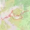
Savin kuk 2313 - Šljeme istočni vrh 2445 - Vrh Šljemena 2455...

Montenegro > Žabljak Municipality > Motički gaj > Begovina

Distance: 13.5 Km • Elevation gain: 1,283 m • Maximum elevation: 2,441 m

Other places

Gear up for your next adventure:

🚨High-Decibel Whistles - Standard safety gear for mountain signaling
🩰Hiking Binoculars - See long distances on trails
🧶Camping String Lights - Ambience and utility lighting
🛶Inflatable Touring Kayaks - Explore Irish loughs and coastal topography
🕶️Polarized Sunglasses - Reduce glare from lakes and sea cliffs

As an Amazon Associate, this site earns from qualifying purchases at no extra cost to you.