Import a GPX file

Кутлесе trails

Click on a trail to view its statistics, map and profile.
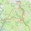
Cigota

Serbia > Central Serbia > Zlatibor Administrative District > Cajetina Municipality > Jablanica > Кутлесе

CIGOTA1-02 15:53:45

Distance: 13.6 Km • Elevation gain: 532 m • Maximum elevation: 1,352 m

Gear up for your next adventure:

🏕️Family Camping Sets - Gear packages for family trips
🔧Bicycle Repair Kits - On‑the‑go bike maintenance tools
🖊️All-Weather Pens - Pressurized ink cartridges that write upside down and in wet
📱Rugged Smartphones - Waterproof phones with long battery for offline mapping
🧴Long-Lasting Sunscreen - Protect against UV rays during long days on the ridges

As an Amazon Associate, this site earns from qualifying purchases at no extra cost to you.